Thursday, April 20, 2017

7 Wonderful Places to Visit in Green Bay


  1. The Automobile Gallery


Remember the old days? When cars had dramatic lines, and burgers were brought to you on roller skates? Well, don’t fret you can always go back in time in The Automobile Gallery. The gallery offers a wide variety of vintage cars with an amazing mix of car models from different eras.  The cars are displayed casually which makes it easy to go around and appreciate its vintage beauty.  The recent renovation matches the theme of the museum; it makes the visit worthwhile for the tourists or even with the locals.

If you are lucky, you can even bumped into the owner! He may even tell you about the priceless stories behind each car and their restoration process.


  1. Meyer Theatre

Image result for meyer theatre


If you want to delight your senses, then head on to the Meyer Theatre.  It can hold around 1,000 people and the great thing about Meyer Theatre is that there is no bad seat in the house. So, even if you booked in the last minute, you can still enjoy their show.  The theater is still a great place to enjoy concerts or even watch locally produced plays.


  1. Green Bay Botanical Garden


This 47-acre botanical garden offers a lot more than the display of numerous amazing flowers and plants.  Green Bay Botanical Garden also houses great architectural buildings great for dramatic selfies.

For the Lord of the Rings fans, a trip to Green Bay Botanical Garden is a must. They have their own hobbit house known as The Les & Dar Stumpf Hobbit House. That will save you a huge amount of time from travelling all the way down to New Zealand.  Another great innovation added to The Les & Dar Stumpf Hobbit House are the solar light tubes and water efficient equipment, proving that as their name suggests, they went green.

Green Bay also offers programs like photography, cooking, and even hiking. Don’t miss out the Garden Fair and WPS Garden of Lights event, where you can walk along their creative display of 250,000 lights during the Holiday festivities.


  1. Walk of Legends


For sport fans, particularly football fans (who doesn’t love Football?) The Oneida Nation Walk of Legends in Green Bay is a walk to take. It can make you burn calories, so you feel like you're in "THE GAME" (just kidding)- but you will enjoy the scenery at Green Bay, and perhaps get to know more about the locals.  The Walk of Legends is comprisesdof 24 monuments which immortalize the football history in the area.


  1. Neville Public Museum

https://upload.wikimedia.org/wikipedia/commons/6/65/Neville_Public_Museum_Dinosaur_Sculpture_Re-dedication.JPG


A trip to a new destination isn’t complete without a visit to a local museum, especially if you have kids. Neville Public Museum can tell you all about the Northeast Wisconsin history. They have exhibits ranging from ice age to the present day. They also have diverse subject of art, science and their local history.

Neville Public Museum takes pride of their permanent exhibit called “On the Edge of the Inland Sea.” Their objective is to educate visitors about the country’s history as the Great Lakes Region.


  1. National Railroad Museum


Since 1958, The National Railroad Museum preserved the history of railroad travel in the country. Their advocacy leads to a collection of more than 70 engines and train carriages. The kids will surely enjoy the “Thomas the Tank Engine” train tour around the museum. Visitors can watch educational films about the history of railroad travel in the country. They also have an impressive collection of old photographs and other transportation mementos; some are from Hindenburg and Titanic.


  1. Fox River State Recreational Trail


For appreciate the beautiful scenic view of Green Bay, the Fox River State Recreational Trail is highly recommended. It starts in downtown Green Bay area and runs along the Fox River in the northeastern part of Wisconsin.  The popular 20-mile trail goes to the Brown County Line filled with hikers who want to enjoy the Green Bay picturesque view of the Great Lakes Region.

Want To Take A Piece of Green Bay With You?

Then pick up our 3-D Nautical Wood Map of Green Bay-TODAY!

Geren Bay Door County 3 D wood naturical chart


SOURCES:

1. Source
2. Source
3. Source
4. Source
5. Source
6. Source
7.Source


Friday, April 14, 2017

Grand Traverse Bay Wood Maps


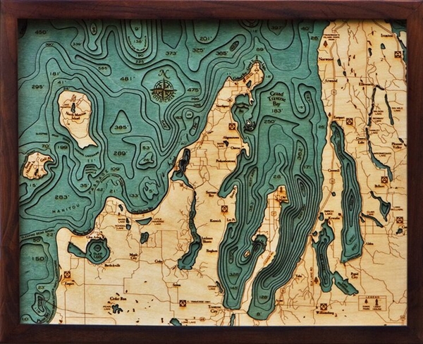
The Leelanau Peninsula in the northwestern area of Lower Peninsula of Michigan formed the Grand Traverse Bay.  From its peak and in the tail part, it measures 32 miles (51 km) long, 10 mi (16km) wide. The deepest part of the bay measures around 620 feet (190 m). The Old Mission Peninsula divides the bay into two parts.
Traverse City is located in the southern part of the bay where the Boardman Rivers exits into the western part. Also, the Grand Traverse has an East and West part. Several significant smaller bays are in the Grand Traverse Bay, namely,
•    Bowers Harbor
•    Northport Bay
•    Old Mission Bay
•    Omena Bay
•    Suttons Bay
buy lake leelanau 3d wood maps

Michigan is the main producer of cherries in the United States. Aside from these the surrounding countryside of the Grand Traverse Bay also produces grapes for Michigan’s wine business. The long stretch of sand means a number of great beaches offer various activities and a popular tourist destination.

Activities near the Grand Traverse Bay include:

  • Swimming in several beaches
  • Boating
  • SUP- Stand Up Paddle Boarding
  • Camping
  • Fishing
  • Kayaking

Boating at the Grand Traverse Bay


Grand Traverse Bay contains several smaller bays which surrounds the main bay. The best place to dock a boat is at the Northport Public Marina.  The bay is one of the best places to go boating for an amazing Great Lake vacation.  Grand Traverse is also famous for its golden sand beaches and pristine blue waters.  Anglers can also enjoy the enormous quantities of fish in the bay.

Fish in the Grand Traverse Bay


The size of Grand Traverse Bay offers an ideal way for boating and fishing. The great thing about the lake is that when fierce storms plagued the main lake, one can simply go fishing to smaller lakes nearby.

Fish available in the bay includes:
•    Steelhead
•    walleye
•    coho salmon
•    smallmouth bass (averaging 7 pounds each)

Famous Beaches


The bay offers several surrounding beaches, from the famous tourist spot beaches down to the off beaten path. Here are the well-known beaches in the Grand Traverse Bay.

•    Bryant Park
-    A few minutes away from Traverse City, the Bryant Part sits on the west side and a great way to see the sunset.
•    Clinch Park
-    This beach offers activities such as kayaking, canoe rentals, and paddle boarding.
• West End Beach
-    This beach is known for partying and socializing. It offers several activities including beach volleyballs, a grass field perfect for playing catch.
•    East Bay Park
-    East Bay Park is the shallowest of all the beaches in Grand Traverse Bay. It also has a camping site and a playground for kids to enjoy.
•    Power Island
-    The island is situated about 3.5 miles from Bowers Harbor on Old Mission Peninsula. It has wooded camping sites, hike trails and sandy beaches.
•    Haserot Beach
-    This beach is one of the off beaten tourist destination because people seldom go here. It’s perfect for undisturbed bonding moments with the family.
•    North Bar Lake
-    The famous Sleeping Bear Dunes makes the 40-minute trip from downtown Traverse City worth it. Sand dunes of 400 feet tall adorned the scenic view of the North Bar Lake.


Wednesday, April 12, 2017

Burt and Mullet Wood Maps

Burt Lake Carved Wood Maps

Carved Wood Maps of Mullet and Burt Lakes in Michigan


Burt Lake is located in Cheboygan Count in Michigan and named after William Austin Burt who made a federal survey from the years 1840 to 1843. The surface of the lake reached up to 17, 120 acre or 69 km2. The lake stretches 10 miles or 16 km from north to south, about 5 miles or 8 km at its widest and 73 feet or 22m at its deepest. The lake serves home to Lake Sturgeon, which temporarily held as the largest sturgeon caught in the United States.

Burt Lake is part of the Inland Waterway. One can ride a boat from Crooked Lake near Petoskey across the northern part of the Lower Peninsula to Cheboygan on Lake Huron. One can find several resorts and camping side along Burt Lake’s location. If you want to just buy our Burt And Mullet Lakes Wood Map here, you can or keep reading for some great info on these fishing havens.

Quick Facts

Area: 69.28 km²
Length: 16 km
Width: 8 km
Surface elevation: 181 m
Outflow location: Indian River


What are activities in Burt Lake?

The most popular activities about Burt Lake comprises of:

•    campground
•    vacation rentals
•     fishing
•    hiking
•    boating
•    cross-country skiing
•    snowmobiling
•    sailing
•    swimming
•     beach
•    state park
•    camping

What are the fishes caught in Burt Lake?


Commonly caught fish in Burt Lakes includes:
•    bass
•    black bass
•     pike
•    rainbow trout
•     brown trout
•    smallmouth bass
•    largemouth bass
•    carp
•    sturgeon
•    sunfish
•    trout
•    muskellunge
•    northern pike
•    yellow perch
•    walleye

Fishing hot spots in Burt Lake are located in Dagwell Point, Colonial Point and Greenman Point. Also, the southern shore of the lake provides, a shelter for fish around the weed lines.


Mullet Lake


The Mullet Lake is located in Cheboygan County in Michigan and named after John Mullet. Mullet along with William Burt made a federal survey of the area between the years 1840 to 1843.

Mullet Lake and its neighboring lake, Burt Lake shares its major inflows from the Indian River. This river also connects the two lakes as well as Pigeon River, Little Pigeon River, and Mullet Creek. The water current of Cheboygan River flows out in the northeastern part of Mullet Lake.

The lake belongs to the Inland Waterway, and once can cross the lake from Crooked Lake about 38 miles or 61 km close to Little Traverse Bay on Lake Michigan. Mullet Lake stretches 10 mi or 16 km long, its widest span is about 4 mi or 6.4 km. The whole surface area of the lake spreads about 16,630 acres or 67.4 km2. Mullet Lake measures 148 ft or 25 m at its deepest.

Quick Facts

Area: 70.25 km²
Length: 16 km
Width: 6.4 km
Surface elevation: 181 m
Outflow location: Cheboygan River

What are activities in Mullet Lake?


The crystal clear water in Mullet Lake provides the best way to walk along its shoreline, go for fishing or cruise along its scenic view. The most popular activities about Mullet Lake comprises of:

•    Kayaking
•    Rafting
•    Fishing
•    boating
•    Pedal-boating
•    Scenic trail
•    Hiking

What Kind of Fish Are Caught in Mullet Lake?


The lake’s clear water makes it easier to reel in fishes. Commonly caught fish in Mullet Lakes includes:
•    bluegill
•    brown bullhead
•    brown trout
•    cisco
•    lake sturgeon
•    muskellunge
•    northern pike
•    pumpkinseed sunfish
•    rainbow trout
•    rock bass
•    smallmouth bass
•    walleye
•    white crappie
•    yellow bullhead
•    yellow perch


Tuesday, April 11, 2017

Bass Islands-Lake Erie

Lake Erie How Was It Formed?


Lake Erie was formed during the glacial period when huge ice sheets moved from Canada towards Ohio. These glaciers scratched the bedrock and their enormous weight created deep depressions. Melted ice then filled the depression shaping the Great Lakes.

The lake holds the title as the shallowest of the Great Lakes. The shallowest part of Lake Erie is at 25 feet in the western basin, 61 feet in the central basin and 120 feet in the eastern basin. Because of the uneven footbed, vicious storms often occur in the shallow basin of the lake.

Also, Lake Erie yields more  abundant varieties of fish than the other Great Lakes. The yearly catch in Lake Eerie equals that of all Great Lakes combined.

The lake's warm temperatures produce greater numbers and varieties of fish than any other Great Lakes, including channel catfish, smallmouth bass, walleye, white bass and yellow perch.

North Bass Island


North Bass Island is the second largest land in the northernmost part of the Bass Island. It sits in Lake Erie Island in Ohio and part of Put-in-Bay Township of Ottawa County. It is located 18 miles from central Ohio and just 2 miles from the Canadian border.  Manila Bay sits on the southwest corner of the island along with an unnamed creek that extends from the bay.

The island is one of the few remaining island left untouched with commercial development.  The state of Ohio purchased the 589 acres (2.4 km2) of land out of the 688.9 acres (2.79 km2) to preserve it. Also, authorities operate the island as North Bass Island State Park.

Isle Saint George, a small independent community lies within the island. As of 2007, the island houses two dozen permanent residents in 12 privately owned estates.  In the past, North Bass was mostly vineyard.

Things to do in North Bass Island


Fishing is allowed in appropriate areas along the 4.1 miles shoreline. One must first get a valid Ohio fishing license
•    Camping
•    Fishing
•    Picnicking

•    Trail hiking

Nearby Attractions:


•    Catawba Island State Park
•    East Harbor State Park
•    Kelleys Island State Park
•    Lake Erie Shores & Islands
•    Middle Bass Island State Park
•    Oak Point State Park
•    South Bass Island State Park

South Bass Island


South Bass Island is located at the southernmost part out of the three Bass Islands in Ottawa County, Ohio. It rests on a small island west of Lake Erie and 3 miles (4.6km) from it south shore. Moreover, the island is a popular destination for recreational activities.

The island is approximately 3.7 miles (6 km) long and 1.5 miles (2.4 km) wide. South Bass Island covers 1,588 acres (642.8 hectares) of land. An airfield is built in the southwestern part and a residential community on the northeastern side. As of 2000 census, the island houses 631 permanent residents.

Also, South Bass Island often called as the ‘Key West’ of Lake Erie because of different activities it offers. The island also boasts of historical monuments such as Perry's Victory and International Peace Memorial honoring the Battle of Lake Erie. The island serves as the annual host for the Inter-Lake Yachting Association race called Bay Week.

Things to do on South Bass Island

•    Boating
•    Fishing
•    Picnicking
•    Swimming
•    Winter activities such as ice skating and ice fishing
•    Camping


Nearby Attractions


•    Perry's Victory & International Peace Monument
•    Put-in-Bay
•    East Harbor State Park
•    Marblehead Lighthouse State Park  
•    Kelley’s Island State Park  
•    North Pond and North Shore Alvar  

Thursday, March 30, 2017

Buy Sea Inspired Home Décor

Sea inspired DIY décor


Vitamin SEA serves as the best de-stressing of all time. If you can’t get enough of the sea, maybe it is time to incorporate it into your home. Do not fret, sea-inspired decors are really easy to pull off and create a very uplifting mood. It is also very easy to DIY. The mix of colors like blue, light gray, and white produce a very calming and casual ambiance in your home.

Wood Maps Of Your Favorite Vacation Spot

Depth Chart Custom Wood Map From Carved lake art
We love travelling. We love collecting memories. What better way to remember your boating trips or visits to the shore than with a custom laser cut topographical map? Not into Maps? Try a Wood Topographical Coffee table, or custom clock.

Cleverly Arrange Curtains


Related image


Sunlight and creates a very radiant backdrop for your other home décor. The trick is to elegantly drape the window and not conceal it with heavy curtains. Using a natural wood to hang the curtain will give out a very dramatic effect.

Themed Corner Board

Image result for travel map with pins


Make use of the nook in a corner of your house. Put in a themed designed board or a wood crafted map to instantly create a sea bound atmosphere. It will be more fun if you put on a map, using pushpins mark the places you’ve been. You can also make flat pins using shells or other mementos from your trip. If however, you have not been on a vacation for some time, use the board to mark where you want to go. The board will also bring inspiration to plan those perfect vacations.


Artsy Centerpiece

Make use of those shell collections. Instead of storing them somewhere in the house try arranging them in artfully and add some candles. It will instantly give you the ocean feeling.Image result for shells centerpiece


Ocean in a vase

Image result for tabletop beach


If arranging is not your talent you can opt for a more minimalist theme. Put a well-rounded conch in a glass container and pour sand into it. You can let the vase be the center of the attention or rest some starfish or another shell into the vase to complete sea inspired décor.


Use Natural Wood

Bring out the natural beauty of the wood by arranging them into sea creatures, boat or anchor. Recycle wood into an artistic masterpiece creates a bold statement in your home. 29 Beach Crafts: Coastal DIY Wall Art


Make a drape made of shells
Punch small holes in shells and use a wooden string to tie them together to create an interesting array of sea shells. You can put them over a mirror or use them to bind to tie your curtains. These shells can also make your shower curtains a lot more fun.beach-diy-decor-ideas-17


Knotty Coaster

These nautical coasters made with white ropes gives out the feeling of being on a yacht out in the open seas.

Protect your surfaces in style with these nautical knotted rope coasters.
Get the tutorial at Sally Lee by the Sea.


Netted Mason Jars

Image result for netted mason jars

Make an interesting centerpiece with these netted mason jars. Choose a jar that already has a hint of blue color fill it with sand and candles to make it more spectacular. You can either put it in the entrance hallway or hang it on by the porch.

Shells by the door

beach-diy-decor-ideas-29
Transform an ordinary doorway into an attractive corner. Glue in shells and starfish on top of the hangers to set the sea inspired theme in your house.


Image Credits:

Monday, March 27, 2017

How Lakes Were Formed [Great Lakes]

Lake Art Shows How Lakes Were Formed?

Topographical Wood Map Of The Great Lakes. Laser Cut.

Lakes are bodies of water contained in a basin and surrounded by land. Millions of lakes are scattered all over the world. Lakes are formed in every kind of environment known to man; near the shoreline, plains, and mountains even in deserts.  The water found in lakes either comes from snow, melting ice, streams, rain and groundwater outflow. Also, lakes contain mostly freshwater. Moreover, lakes vary in sizes; some are just a few square meters others which are called ponds.

Others are big enough to be called seas. Movement in the Earth’s tectonic plates, glaciers, and volcanic activity create lakes. As well as the wind and river currents help to form lakes. Most of the lakes fill a low-lying area in the earth’s surface referred to as basins. Tectonic Lakes The movement in the Earth’s surface possibly in higher ground or mountain, hills or plateau creates depression along the rupture course.

When the surface cracks or breaks faults may form. In time water filled these faults from rainfall or another source of water leakage which forms lakes. Glacial Lakes Estimated about 20,000 years ago, glaciers started peaking in the Earth’s surface; subsequently, it began to slowly melt.  Water from the glacier sheets retreating filled the low-lying areas within the Earth’s surface. Around 18,000 years ago melting glaciers formed numerous lakes in the Northern Hemisphere.

Volcanic Lakes

Volcanoes often form lakes. When a volcano becomes inactive, water or melted snow may fill the crater. This happens when precipitation occurs more quickly than evaporation. Occasionally the peak of the volcano may collapse or blown off leaving a hollow referred to as caldera. Rainwater may also fill the caldera and eventually became a lake.

Rivers also form lakes as they flow back and forth expansively across the plains which called meanders. As the river expands, it may create another way to circumvent a river leaving a body of still water, which also forms lakes.

Salt Lakes

Salt lakes or saline lakes were formed when water containing minerals and salt cannot leave because there is no natural outlet in the lake. The water with high level of salinity evaporates leaving the minerals behind.  

Landslides or Ice-dam Lakes

When glacial ice blocks a river or a body of water it forms a lake. In the past, glacial ice dams created a massive surge of floods. Similarly, landslides can also form lakes since there will be a huge buildup of water behind the massive rocks. Man-made Lake or Reservoir Humans can also replicate nature. Man-made lake or reservoir usually serves the purpose of storing and collecting water.

It is used for irrigation or for community water supply to protect them from drought or floods. Usually, engineers construct a dam across a flowing river to create a lake. Other lakes Few other lakes originated from sinkhole activity. A collapse in the outer layer of the earth can cause a depression or a hole in the ground. There are instances that these sinkholes are connected to a water leakage which fills them completely. Carved Lake Art